.png)
 German (DE)
  English (US)
  Spanish (ES)
  French (FR)
  Hindi (IN)
  Italian (IT)
  Russian (RU)
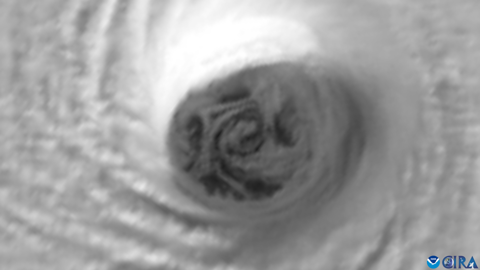
Hurricane Melissa's deadly spin is visible from space.
Satellite footage caught the hurricane in rotation on Tuesday (Oct. 28) as it wreaked destruction across the Caribbean. Imagery from the GOES-19 satellite shows "mesovortices" surrounding the hole, according to the National Oceanic and Atmospheric Administration (NOAA).
Emergency authorities told the Associated Press that Melissa is one of the most powerful Atlantic Ocean hurricanes ever recorded. Human-driven climate change has caused an overall intensification of extreme weather, including hurricanes.
Melissa hit Jamaica on Oct. 28 as a Category 5 storm (the strongest type of storm) with winds of 185 miles per hour (295 kilometers per hour).
Desmond McKenzie, deputy chair of Jamaica's disaster risk management council, declined to share how many people have died, although authorities separately told AP at least four deaths occurred in southwest Jamaica. Roughly 72% of the island has no power and 65% of mobile phone sites are down.
In Haiti, AP added, at least 25 people were killed and 18 others missing following flooding. Cuba had no reported deaths after Melissa hit as a Category 3 on Wednesday (Oct. 29), but "many communities were still without electricity, Internet and telephone service because of downed transformers and power lines," AP stated.
As of Thursday (Oct. 30) morning, Melissa was classified as a Category 2 storm with top sustained winds nearing 105 mph (169 kph) and is situated roughly 515 miles (830 kilometers) southwest of Bermuda, which remains under hurricane warning at the time of AP's report.


Comments
Get the most out of News by signing in
Sign In Register